Hautes Tatras - High Tatras
Et autres massifs des Carpates - And other Carpathian massifs


INTRODUCTION


Suite à un trek en 2004 d'une semaine dans les Hautes Tatras, puis à une rencontre, ma vie a basculé et j'habite dorénavant en Pologne.
Cette page était initialement destinée à présenter les Tatras telles que je les ai découvertes lors de ce trek.
Puis, comme je réside maintenant à proximité (elles sont à 4h de route par l'autoroute Wrocław-Kraków et la Zakopianka), la rubrique s'est développée (Tatras Blanches et Occidentales), et parallèlement élargie aux massifs de moyenne montagne périphériques: Beskides Żywiecki, Niski, Malá Fatra, sans oublier les Sudètes près de Wrocław. Il nous reste encore du boulot avec les Bieszczady, les Nízke Tatry, le Paradis Slovaque... et encore une bonne partie des Hautes Tatras, dont de grands sommets à 2500 !
Récemment, la rubrique s'est encore élargie à de nouveaux horizons pour sortir du giron Slovaco-Polonais, et mériter le titre de Carpates tout court, suite à un voyage dans les Maramureş et monts Rodnei de Roumanie. Nous ambitionnons de continuer à long terme ces explorations plus lointaines, notamment dans les Gorgany et Čierna-Hora Ukrainiennes, ainsi que les Carpates Méridionales de Roumanie.
Néanmoins, vu que l'épicentre de nos randonnées est encore fortement ancré aux Tatras et leurs environs, je propose de garder la rubrique centrée sur ces dernières.
Following a one-week trek in 2004 in the High Tatras, and an encounter, my life completely changed and I live permanently in Poland.
This page was initially made to introduce the Tatras as I discovered them during this trek.
Since then, I live now nearby (they are 4h far by the motorway Wrocław-Kraków and the Zakopianka), the topic developped (White and Western Tatras), and in parallel to the neighbouring smaller mountain ranges: Beskides Żywiecki, Niski, Malá Fatra, without omitting too the Sudetes nearer from Wrocław. There is still a lot to do with the Bieszczady, the Nízke Tatry, the Slovak Paradise... and also a fairly big part of the Tatras, with some high summits near 2500 !
Recently, the topic also enlarged to new horizons, to go out of the Slovak-Polish neighbourhood, and deserve the simple title of Carpathians, following to a trip in the Maramureş and Rodnei mountains of Romania. We are looking forward to explore in the long term more of these remote places, especially in the Ukrainian Gorgany and Čierna-Hora, as well as the Meridional Carpathians of Romania.
Indeed, since the epicentre of our hikes is still solidly anchored to the Tatras and their neighbourhood, I propose to keep the topic of this page focused on them.


Etapes - Stages
No:

-
-
51
50
49
48
47
46
45
-
44
43
42
41
40
39
-
38
37
36
35
34
33
32
31
30
29
-
28
27
26
25
24
23
-
-
22
21
20
19
18
-
-
17
-
-
16
15
14
13
12
11
-
-
-
10
9
8
7
6
5
4
3
2
1
-
Sommet, Lieu
Summit, Place

Červený Kláštor
Przełom Białki
Szumiąca
Swińska Góra
Lubań
Luboń Wielki
Jaworzyna Kamienicka & Kiczora
Kozi Wierch - Granaty
Jakubina
Ponice
Baranec
Štrbský Štít
Kriváň

Spišská Bukovina
Gęsia Szyja
Zelené Pleso
Javorina
Baranie Rohy
Jahňací Štít
Szpiglasowy Wierch
Kościelec & Świnica
Krzyżne
Veľký Choc
Kvačianska & Prosiecka Dolina
Smrekov - Krížna
Borišov - Ostredok
Rakytov - Ploská
Vlkolínec
Wielka Rycerzowa
Východná Vysoká
Široká veža
Predné Solisko
Ineu
Pietrosul
Maramureş
Valea Izei
Tomášovský Výhľad
Bystrá
Boboty
Chleb
Rozsutec
Štefanová
Bardejov
Magura Małastowska
Wołowiec
Bartne
Czerwony Wierch
Wołowiec
Starorobocianski Wierch
Pilsko
Široké Sedlo
Spišská Magurka
Ždiar
Sromowce Niżne
Dunajec
Sokolica & Trzy Korony
Turbacz
Babia Góra
Ladové Pleso
Kôprovský Štít
Ostrva
Téryho Chata
Veľká Svišťovka
Hlúpy Štít
Giewont
Zakopane
Altitude
Height

-
-
831m
805m
1211 m
1022 m
1288 m
2291 m
2194 m
-
2184 m
2385 m
2494 m
1176 m
1489 m
1551 m
-
2526 m
2229 m
2172 m
2301 m
2112 m
1611 m
-
1574 m
1592 m
1567 m
-
1226 m
2428 m
2373 m
2093 m
2279 m
2303 m
-
-
667 m
2248 m
1092 m
1647 m
1609 m
-
-
813 m
-
-
2122 m
2063 m
2172 m
1557 m
1830 m
1112 m
-
-
-
983 m
1210 m
1825 m
1924 m
2363 m
1979 m
2015 m
2037 m
2060 m
1904 m
-
Zone
Area

Pieniny
Spisz

Gorce
Gorce
Gorce
Gorce
Gorce

H. Tatras
W. Tatras
Gorce
W. Tatras
H. Tatras
H. Tatras

B. Tatras
H. Tatras
H. Tatras

B. Tatras
H. Tatras
H. Tatras
H. Tatras
H. Tatras
H. Tatras

Chočské V.
Chočské V.
Veľká Fatra
Veľká Fatra
Veľká Fatra
Veľká Fatra

Beskides Z.
H. Tatras
H. Tatras
H. Tatras

Iza valley
Iza valley
Rodnei
Rodnei

Slovenský Raj
W.Tatras
Malá Fatra
Malá Fatra
Malá Fatra
Malá Fatra

Beskides N.
Beskides N.
Beskides N.
Beskides N.

W.Tatras
W.Tatras
W.Tatras

Beskides Z.
B. Tatras
B. Tatras
B. Tatras

Beskides Z.
Gorce
Pieniny
Pieniny
Pieniny

H. Tatras
H. Tatras
H. Tatras
H. Tatras
H. Tatras

B. Tatras
W.Tatras
W. Tatras
Pays
Country

.
.
.
.
.
.
.
.
.
.
.
.
.
.
.
.
.
.
.
.
.
.
.
.
.
.
.
.
.
.
.
.
.
.
.
.
.
.
.
.
.
.
.
.
.
.
.
.
.
.
.
.
.
.
.
.
.
.
.
.
.
.
.
.
.
.
Date
Date

05/08/08
04/08/08
03/08/08
02/08/08
01/08/08
31/07/08
30/07/08
29/07/08
28/07/08
27/07/08
30/06/08
29/06/08
28/06/08
30/12/07
29/12/07
28/12/07
27/12/07
23/09/07
22/09/07
09/06/07
08/06/07
07/06/07
04/05/07
03/05/07
02/05/07
01/05/07
30/04/07
29/04/07
28/04/07
24/09/06
23/09/06
13/08/06
10/08/06
08/08/06
09/08/06
07/08/06
02/08/06
31/07/06
18/06/06
17/06/06
16/06/06
15/06/06
31/12/05
30/12/05
29/12/05
28/12/05
30/10/05
29/10/05
28/10/05
09/10/05
14/08/05
13/08/05
12/08/05
29/05/05
28/05/05
28/05/05
27/05/05
26/05/05
20/08/04
19/08/04
18/08/04
17/08/04
16/08/04
15/08/04
14/08/04
13/08/04

Mes courses, par zones - My trips, by areas

Ce classement n'est pas censé résumer les principales zones des Carpates. J'ai plutôt essayé de classer mes excursions, dont la dispersion est inégale, en 5 groupes géographiques. Généralement, chaque région fait l'objet d'un séjour de plusieurs jours.
This classification is not supposed to make an abstract of the main Carpatian zones. I rather tried to sort my excursions, whose dispersal is uneven, into 5 geographic groups. In general, each region is the topic of a trip of several days.

Beskides de Żywiec - Żywiec's Beskides
Beskid Żywiecki

Beskid Żywiecki Oravské Beskydy
(Des frontières Tchéco-Slovaquo-Polonaise au piémont des Tatras)

Petites & Grandes Fatra & Choc - Small & Big Fatra & Choc
Malá Fatra & Veľká Fatra

Malá Fatra & Veľká Fatra & Chočské Vrchy
(Slovaquie, région de Liptov)

Tatras Occidentales - Western Tatras
Tatras Occidentales
Tatry Zachodnie Západné Tatry
(Des Chočské Vrchy à Giewont)

Hautes Tatras - High Tatras
Hautes Tatras
Tatry Wysokie Vysoké Tatry
(Coeur granitique)

Tatras Blanches - White Tatras
Tatras Blanches
Tatry Bielskie Belianske Tatry
(De Kopské Sedlo à la région de Spisz)

Petites Beskides - Small Beskides
Beskid Niski
Beskid Niski Nízké Beskydy
(Du Spisz à l'Est de la Pologne)

Maramureş - Rodnei
Maramureş & Rodnei
Maramureş - Muntii Rodnei
(Carpates Orientales, Roumanie du Nord)

Idées et projets
Dans les Tatras :
- Rysy avec nuit au Chata Pod Rysmi, via Sedlo Váha, retour par Mengusovské sedlo et Mięguszowiecki Szczyt Czarny (guidé ?) si possible hors saison.
- Slavkovský štít, Svišťový štít, en boucle par les Veľká Studená Dolina et Velická dolina.
- Boucle dans la Dolina Roháčska et ascension de Banikov et Ostry Roháč.
- Sivý vrch et nuit à Koliba Pod Náružím.
- Un jour, avec guide ? : Ľadový štít, Lomnica, Gerlach, Kolový Štit, etc...
A proximité :
- Basses Tatras : Salatin depuis Liptovská Lúžna, Dumbier & Ohnište depuis Liptovský Ján
- Excursions en raquettes dans les Bieszczady (à étudier !)
Plus loin :
- Gorgany, Synevir lake, Hoverla, point culminant de l'Ukraine, Carpates Orientales
- Făgăraş, Bucegi, Retezat, Piatra Craiului, Carpates méridionales de Roumanie...
- Rozanski Kukovi, Plitvice, Bijele & Samarske stijene, Croatie...
- Durmitor, Montenegro...
Ideas and projects...
In Tatras :
- Rysy with a night in Chata Pod Rysmi, via Sedlo Váha and return though Mengusovské sedlo (guided ?) if possible out of the high season.
- Slavkovský štít, Svišťový štít, in loop by the Veľká Studená Dolina et Velická dolina.
- Loop in the Dolina Roháčska and climb of Banikov and Ostry Roháč.
- Sivý vrch and night in the Koliba Pod Náružím.
- One day, with a guide ? : Ľadový štít, Lomnica, Gerlach, Kolový Štit, etc
Nearby :
- Low Tatras : Salatin from Liptovská Lúžna, Dumbier & Ohnište from Liptovský Ján
- Excursions in snowshoes in the Bieszczady (to study !)
Further :
- Gorgany, Synevir lake, Hoverla, Ukraine's highest mountain, Oriental Carpathians
- Făgăraş, Bucegi, Retezat, Piatra Craiului, meridional Carpathians of Roumania...
- Rozanski Kukovi, Plitvice, Bijele & Samarske stijene, Croatia...
- Durmitor, in Montenegro...

Sentiers et frontière - Trails and border

De nombreux ouvrages, ou des personnes, mentionnent encore qu'il est interdit de traverser la frontière par les sentiers. Avec l'entrée des deux pays dans l'Espace Schengen en 2008, certains affirment l'extrême inverse ce qui est également erroné. Il est donc bon de faire un point...
En vérité, le passage de la frontière s'était déja considérablement assoupli, longtemps avant même l'adhésion de la Pologne et la Slovaquie à l'UE, en 2004. Jusqu'à présent, deux points de passage étaient officiellement ouverts, aux pics de Rysy et Wołowiec (aux 2 extremites des Tatras Polonaises). Schengen ne signifie pas l'ouverture systématique de tous les points car la règlementation de ceux-ci est également soumise aux règlements des deux parcs Nationaux. Déjà, mentionnons que le 16 Juin, qui représente la fin de la fermeture hivernale annuelle des Hautes Tatras Slovaques, est la date de jonction réelle des sentiers transfrontaliers (et non depuis le 1er Janvier).
A partir du 16 Juin 2008 (jusqu'au 31 Octobre...), la totalité des sentiers transfrontaliers seront ouverts, à l'exception de :
- Kasprowy Wierch (Kasprov vrch)
- Tomanowa Przełęcz (Tomanovské sedlo)
Ces deux exceptions résultent d'un différend entre les deux pays, lié aux fréquentations disproportionnées entre les deux versants en cet endroit précis, du fait de la présence du téléphérique Polonais de Kasprowy Wierch.
Cependant, les principaux intéressés sont loin de faire preuve de mauvaise volonté. Des pourparlers sont en cours pour l'extension de quelques sentiers existants afin de d'ouvrir de nouveaux points, comme aux cols Brobowiecka Przełęcz, Gładka Przełęcz, ou encore une passerelle entre le refuge Roztoka et la vallee Bielovodská. La construction de quelques nouveaux sentiers Slovaques est aussi à l'étude. Souhaitons que tout ceci voie le jour...

Enfin, quelques dernier détails
- Si le passage ne requiert plus de contrôle, cela ne signifie pas moins que vous devez toujours emmener vos pièces d'identité dans le sac-à-dos (même pour une boucle en revenant dans le même pays).
- N'oubliez pas qu'il est interdit, dans le TPN comme dans le TANAP (Parcs Nationaux), de quitter les sentiers balisés (camping également prohibé). Il existe cependant des derrogations à ces règles, si vous êtes accompagnés d'un guide reconnu, et, en Slovaquie uniquement, pour presque toutes les zones, si vous êtes affiliés à un Club Alpin national (le CAF en l'occurence). Ne râlez pas, c'est pour protéger la faune, notamment le Chamois en voie de disparition...
- Les Beskides, excepté les autres parcs comme Babia Góra et les Pieniny, ne sont pas concernées par les interdictions de hors-sentier. - Fermeture hivernale des Tatras Slovaques (exemple sur l'image ci-dessous), mais uniquement pour les hauts sentiers, généralement ceux situés en amont des refuges. Exception faite pour les cas cités ci-dessus (alpinisme hivernal)
A wide number of books, as well as some people, that it is strictly forbidden to cross the border by the hiking trails. With the entrance of both countries in the Schengen space since 2008, some others affirm the total opposite, which is also not true. Let's explain it then...
Indeed, the crossing was quite flexible since long ago, even long before the entrance of Poland and Slovakia in the EU in 2004. So far, only two points were officially opened, at the peaks of Rysy and Wołowiec (the 2 far ends of Polish Tatras). Schengen does not mean the systematic opening of all points, since their rules are submitted also to the laws of both National parcs. Let's mention already that the 16th of June, which represents the end of the Annual winter closure of the Slovak High Tatras, is the real date of junction of the trans-border trails (and not since January 1st).
From June 16th 2008 (until October 31th...) the totality of the international trails will be opened, apart from the following exceptions :
- Kasprowy Wierch (Kasprov vrch)
- Tomanowa Przełęcz (Tomanovské sedlo)
These exceptions are due to disagreements between both countries, resulting from the disproportioned frequentation in this zone, due to the presence of the Kasprowy Wierch chairlift on the Polish side.
Anyway, the main actors are far to behave egoistically. Some negociations are currently being held in order to open some new points, like the passes Brobowiecka Przełęcz, Gładka Przełęcz, as well as a bridge between the Roztoka hut and the Bielovodská valley. The building of some new slovakian trails is also considered. Let's hope all of this will be realized soon...

Let's remind some last details
- If the crossig does not require anymore controls, this means that you still must carry your identity papers into your rucksack. (even for a loop coming back to the same country).
- Keep in mind that it is forbidden, in the TPN as well as in the TANAP (National Parks), to leave marked trails (camping is also prohibed). Some derrogations to these rules exists, for almost all areas when you are accompanied with a registered mountain guide, and, in Slovakia only, if you are a member of a National mountaineering club (SMC, BMC, etc..). Don't complain, this is to protect fauna, especially the Chamois, endangered specie...
- The Beskides, except the other parcs like Babia Góra and the Pieniny, are not concerned by the off-trail rules. - Winter closure in Slovakian Tatras (example on the picture below), but only fot thethe high trails, generally those located upstream from the mountain-huts. Except for cases already mentioned above (winter mountaineering).
Autres pays des Carpates :
- La République Tchèque, dont une partie des Besdides fait partie, est également dans l'espace Schengen et tout est ouvert avec Pologne et Slovaquie. Idem pour les montagnes Hongroises près de la Slovaquie.
- La Roumanie est dans l'UE mais pas dans Schengen. Pour les ressortissants Français, une carte d'identité suffit, pas de visa ni de passeport obligatoire.
- L'Ukraine ne fait ni partie de Schengen ni de l'UE. Cependant, depuis le changement de régime en 2006, les visas ne sont plus obligatoires. Mais les passeports le restent. Dans les Carpates, aucun point transfrontalier n'existe ni avec la Pologne ni avec la Slovaquie, même si un projet d'ouverture est à l'étude pour Wołosate dans les Bieszczady. Entre les Carpates Roumaines et Ukrainiennes, il est désormais possible pour les touristes de transiter à Sighet-Solotvino depuis fin 2006.
Other Carpathian countries :
- Czech Repiblic, in which a part of the Besdides belong, also is in the Schengen space, and everything is open with Poland and Slovakia. Same with the Hungarian mountains close to Slovakia.
- Romania belongs to the UE but not Schengen. For UE citizend, an ID card (passport for UK) is enough, no visa neither passeport required (except UK).
- Ukraine does not belong to Schengen neither the UE. But indeed, since the democratic changes of 2006, visas are not required anymore. But passeports still. In the Carpathian range, no trans-border trail exist with Poland neither Slovakia, despite a project is currently considered for Wołosate in the Bieszczady. Between the Romanian and Ukrainian Carpathians, it is now possible for tourists to transit at Sighet-Solotvino since the end of 2006.


LIVRES BOOKS
A ma connaissance, il n'existe aucun guide de randonnée en Français sur les Tatras, alors j'ai dû m'en procurer en Anglais. J'en ai retenu deux, très complémentaires.
L'un, (High Tatra, Stanislav Samuhel, the Rother Walking Guide), est très convivial et ergonomique, mais assez succint en information.
L'autre (The High Tatras, Colin Saunders & Renata Narozna, the Cicerone Guides) très complet, décrit absolument tous les sentiers, mais a beaucoup à gagner en clarté, et peut décourager au premier abord celui qui prépare un itinéraire.
C'est le mélange des deux qui a figé mon itinéraire.
Enfin, pour LA carte (car presque tout passe sur une grande 1/50 000 !), il est très facile de se la procurer partout, d'une multitude d'éditeurs. En ce qui me concerne, des amis m'en avaient prêté une sous forme de livret, au 1/25 000. A moins de se la procurer sur internet ! (voir liens)
I only found walking guides about Tatras in English (possibly some as well in German... but sorry for the Dutch and the Spannish !). Two of them, quite complementary, focused my attention.
One, (High Tatra, Stanislav Samuhel, the Rother Walking Guide), is very friendly and easy to use, but a bit short in information.
The other (The High Tatras, Colin Saunders & Renata Narozna, the Cicerone Guides) is packed with informations, describes all the paths, but ergonomy could be improved, and it could discourage at first sight the one who is planning a route.
The mix of both of them helped to set my route.
Finally, for THE map (since nearly everything fits in a big 1/50 000 !), it is easy to buy it anywhere, and from a multitude of editors. Concerning me, some friends lend me a booklet one, at the 1/25 000 scale. Otherwise, why not taking it from the internet ! (see links)

High Tatra, Stanislav Samuhel, Rother Walking Guide
High Tatra
Stanislav Samuhel
Rother Walking Guide
The High Tatras, Colin Saunders & Renata Narozna, the Cicerone Guides
The High Tatras
Colin Saunders & Renata Narozna
the Cicerone Guides


Podrobny Turisticky Atlas,VKU Harmanec
Tatry 1/25 000
Podrobny Turisticky Atlas
VKU Harmanec

LIENS LINKS
Là aussi, les sites en Français se font relativement rares. Je me contenterai de les trier en 3 catégories: Les carnets de voyage, spécifiquement en français, les portails et sites persos en Anglais (l'essentiel de l'information), et enfin quelques sites en Slovaque ou Polonais, mais qui méritent quand même d'être mentionnés. Here there are some of the main websites about Tatra, with most of the information. I added some in French language, as well as few other ones in Polish and Slovak languages, which deserve well to be mentioned for their content anyway.
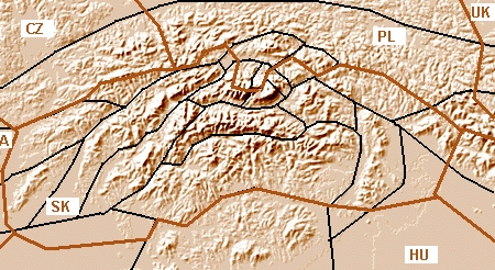
Carnets de voyage : (travelogues, in french)
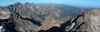
Traversée des Tatras Polonaises 2003 (ski rando), de Denali-Sud
Raid à ski dans les Tatras, de Rémi Aubel
Traversée des Tatras, (ski rando), de Fab Roulier & Jean-Marie Martin
Hautes Tatras, de Cecilia Himpe
Pologne-Slovaquie 2005, de Fabrice BRUN
Ski-trip in Tatras 2005, de Lilian Martinez
Slovaquie 2005, de Rémi Pradelle
Le CAB Brabant dans les Tatras, 1994, "from Lolo and Stevo"
Discover Zakopane, de Altius
Zakopane on-line, Site informatif sur Zakopane et la région assez intéressant.
Cuisine traditionelle, de Aleksandra Delrieu (Beskid)

Travelogues: (in english)
The High Tatras, by Chris Togneri
Tatras, July 2001, by Simon HJ Stevens

Avion - Planes
Sky Europe. Lie Cracovie à beaucoup de métropoles dont Paris, et Londres à Kosice et Poprad.
Links Kraków to a lot of large cities (inc. London) , as well as this one with Kosice and Poprad
Ryanair. Lie Cracovie à Glasgow et Londres, et bientôt Londres à Poprad.
Links Kraków to Glasgow and London, as soon this one with Poprad
Centralwings. Lie Londres à Cracovie . Links London to Kraków.
Wizz Air. Lie Katowice à toutes les capitales, mais peu commode. Links Katowice to several capitals, but not so practical.
Aéroport de Poprad. A surveiller, cet aéroport est voué à ouvrir une multitude de nouvelles lignes à court terme.
Keep an eye on it, this airport is to open a lot of new destinations in a near future.

Notez bien que la jadis célèbre compagnie Air Polonia n'existe plus.
Note that the formerly well know Air Polonia doesn't exist anymore...

Trains
PKP: Chemins de fer Polonais, site en Anglais. Polish railways, site in English.
ZSR: Chemins de fer Slovaques, idem. Slovak Railways, idem.
Ces deux sites semblent utiliser le même moteur de calcul de correspondances.
This two sites seem to use the same connection calculation engine.

Autobus
Poprad - Łysa Polana: Horaires des bus desservant tous les arrêts de la Nationale sur le piémont Slovaque.
Timetable of coaches that serve all stops on the main road on the Slovak montainside.
Kežmarok-Ždiar: Horaires d'une autre ligne utile. Timetable of another useful line.

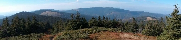
Refuges & Cabanes, d'Est en Ouest - Mountain Huts & Shelters, from East to West
Hautes Tatras - High Tatras
(Vysoké Tatry - Tatry Wysokie)
Chata Plesnivec
Chata pri Zelenom Plese
Zamkovského Chata
Téryho Chata
Zbojnická Chata
Sliezsky Dom
Chata Popradské Pleso
Chata Solisko
Chata Pod Rysmi
Schronisko Morskie Oko
Schronisko Roztoka
Schronisko Pięciu Stawów
Tatras Occidentales - Western Tatras
(Západné Tatry - Zachodnie Tatry)
Schronisko Murowaniec
Hotel Kalatówki
Schronisko Kondratowa
Schronisko na Hali Ornak
Schronisko Chocholowska
Koliba pod Klinom
Koliba pod Pustým
Žiarska Chata
Koliba Pod Náružím

Gites & Hotels que je recommande - B&B & Backpacker accomodations which I recommend
PTTK Youth Hostel, in Zakopane
Tom Turysty Youth Hostel, in Zakopane
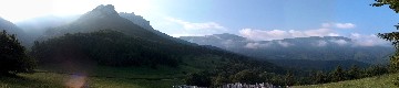
Gîtes à Ždiar Accomodations in Ždiar ; Je recommande Pension Alena (I recommend)
Furmanec, Une autre à Ždiar, bien sympa.Another one in Ždiar, quite friendly.
Gorska Hawira, Koscielisko. Sympa, et ideal pour les Tatras Occidentales.Nice, and ideal base for the Western Tatras

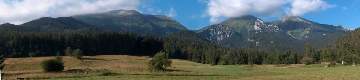
Pologne et Slovaquie sur le net- Poland and Slovakia on the web
Beskid.com (french), Le site francophone n°1 sur la Pologne.
Slovensko.com Visitors' Corner (english/french), Slovakia's most visited forum, with a french category.
Slovenskooooo ! (french/english), la page perso de Mélanie, probablement ce qui existe de mieux pour tout savoir sur la Slovaquie.
Inside-Slovakia (french/english), le site de Pavol sur la Slovaquie, un autre joli travail.
SLOVAQUE-Guide, de Katarina, Slovaque Francophone. Un peu touffu, mais riche en infos sur le milieu associatif Franco-Slovaque.
HIKING.SK's English forum, more focused on hiking. Lots of experts here.
HikePlanner.EUHiking.sk 's tool. Find your trails connections in Slovak mountains as easily as London's Metro !
Wrocławski Klub Wysokogórski (Polish), mon club alpin - my alpine club

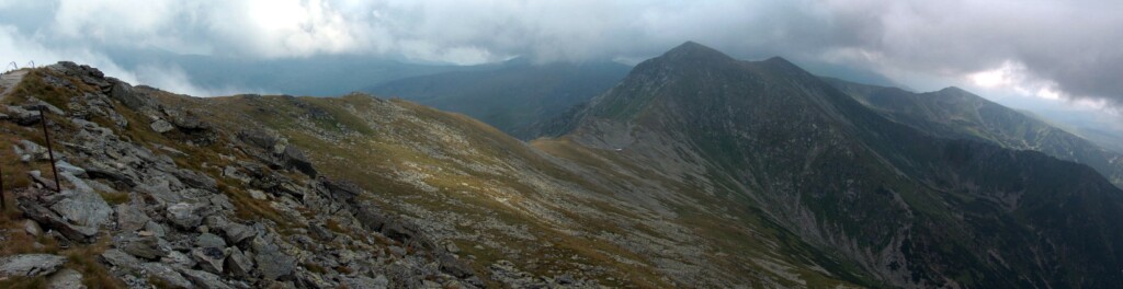
Parcs Nationaux - National Parks (English / Polish)
TANAP, Slovakia's Park. Rich and useful information in English.
TPN, Poland's Park. Still only in Polish, and short.

Main information websites : (english)
Tatry.NET
Tatry.ORG
VysokeTatry.ORG

Some very good homepages : (english)
Tatry.CZ, by Libor Bolda, Ondra Bílek, et Aleš Juchelka. Very good site, very helpful authors.
VysokeTatry.COM, by Rudolf Kukura. A little messy (especially the choice of languages), but a very dense content. Slovak Tatras only, as well as other touristic places in this country.
The Tatra Mountains Virtual Tourist, de Mariusz Markiewicz, very good homepage introcing Tatra for foreigners.
Tatromaniak's guide, by "Tatromaniak". The site of a fanatic ! Rich cultural content.
Tatra Mountaineering Pages, by Dariusz T. Oczkowicz. Nice artistic pictures, well classified by zones and valleys.
Zakopane-life, What to do in Zakopane, for tourists.
The Crown of the Tatra , list of the peaks, for fit hikers !

Some sites only in "local" language (Slovak/Polish ; but it is easy to surf in them, at least for the photos)
High Tatras Mountainguides. For those looking to hire a guide, for off-track trips. Very beautiful photography section.
High Tatras - mountaineering guide. Unfortunately, only the introduction is in english. For those looking for rockclimbing routes; every way on every peak's faces are shown !
Tatry.Info, by Pacyfka. A lot of nice pictures, from many places on both sides of the Tatras, and a lot of information (for natives..)
Górskie Wedrówki, by Halina. Already quoted in the Pyrenees section for its wonderful galleries also including Tatras.
Panoramas of the High Tatras, by Jubi. High quality panoramics of Tatras. A must-see.
E-Tatry.com, by Jarko. The most active site of the Polish Tatras hikers community.
Foto-e-Tatry.com, its photo-album connected.

Météo montagne - Mountain weather forecast (English)
THEYR.NET Site météo gratuit, assez fiable, va jusqu'à 3 jours. Sélectionnez Europe Centrale & Hongrie.
Free weather forecast, quite reliable, goes up to 3 days; Select Central Europe & Hungary
POGODA.ONET.PL Météo pour Zakopane, en Polonais (le jour du mois vous guidera). Correspond en général assez bien aux prévisions de l'autre.
Weather forecast for Zakopane, in Polish (follow the day of the month). Usually matching the forecast of the previous one.
METEO.SK Météo Slovaque. Cliquez sur Poprad.
Slovak Weather forecast. Click on Poprad.

Westwind, Rain Site météo pro moins ergonomique mais très fiable, va jurqu'à 7 jours. Carte des précipitations en Europe Centrale.
Pro site less ergonomic but very reliable. Map of rains in Central Europe
Westwind, Clouds Idem, carte de la couverture nuageuse en Europe Centrale.
Idem, map of clouds in Central Europe
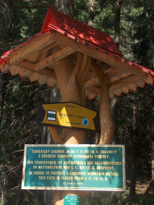
TANAP Trails Update Etat et ouverture des sentiers, à consulter au même titre, surtout hors saison et en début d'été !
Statement and open trails, to check as well, especially out of the high season, and summer's beginning !

Webcams (english)
Slovak Tatras Webcams Consultez les en même temps que la météo. Vous aurez une idée plus précise de ce qui peut vous attendre ! Check them in the same time than the weather forecast, so you'll know what to expect !.

Cartes - Maps (english)
High Tatras Map Online The 1/50 000 map of main Tatras ridge online. Mainly the highest Slovak areas (covers Zakopane/Poprad, and from Kasprov Vrch to Belianske Tatra).
Mapa Vysokých Tatier Even better, this one is at 1/25 000. Slovak and Polish High Tatras (covers Zakopane/Štrbské Pleso, and from Kasprov Vrch to Belianske Tatra).
Mapy TatrThe same on a Polish site, a huge JPEG.
Mapy Tatry Zachodnie The equivalent for Western Tatras, another huge JPEG. Covers Poronin to Rysy, and from Ostrý Rohác to Morskie Oko.
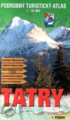
Tatras Maps. To buy more specific maps (paper).
Beskidy Maps. Click on the back-side icons of maps; accurate trails maps available there.
Mapovy server (Czech / English): A wide choice of map scans of all European countries, including Poland, Slovakia, Czech rep.
Horska Hoza. All maps of Slovak mountains.


Les autres massifs que j'ai parcouru - Other mountain ranges I have walked

PYRENEES
Pyrénées

ECOSSE
Ecosse-Scotland

AUVERGNE
Auvergne

Alpes
Alpes

SUDETES
Sudetes


Autres parties du site: Other parts of the site:

Contact
Signez mon livre de visites - Sign my guestbook
Ecrivez moi - Write me
Retour à... - Back to...
Sommaire Principal
Main Index
Sudetes Beskides Żywiecki Beskides Niski Bieszczady Gorce Pieniny West Tatras High Tatras White Tatras Malá Fatra Veľká Fatra Nizké Tatry Slovak Raj Matra